pilotPlan
A digital atlas of urban and architectural evolution of Brasilia
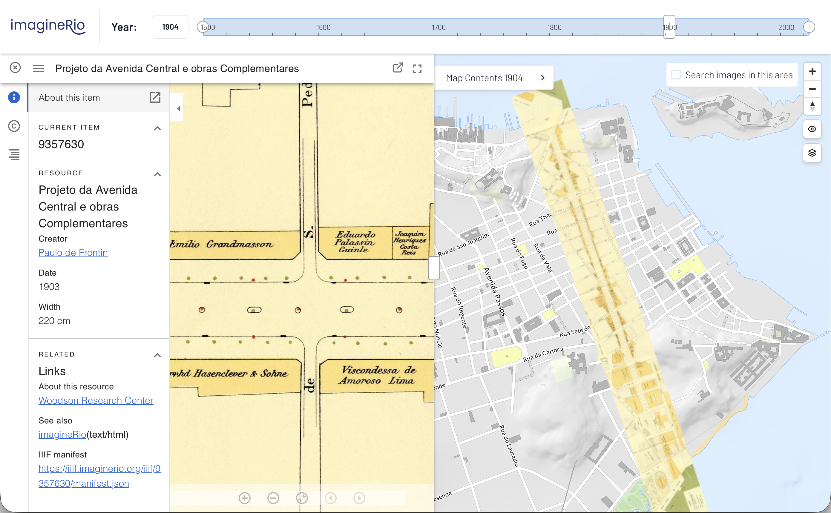
pilotPlan is an online mapping platform that illustrates the urban evolution of Brasilia, Brazil's capital city, over its entire prehistory, history, and possible futures. Primary sources, such as views, maps, architectural plans, and hyperspectral imagery are located in time and space while their associated visual and geographic data are integrated across a number of databases, including an open-access digital library of images, a geographic information system, an open source relational database, and a content delivery web service.
pilotPlan is an evolution of previous work such as the imagineRio, diverseLevant, and instituteRice projects. Instead of a Node application that processes data requests and renders raster map tiles, pilotPlan is a serverless application that greatly reduces the complexity and maintenance required for handling the practically limitless unique map views from different combinations of user-selected years and layers. Vector tiles act as both display and database—the map itself contains all the necessary information for querying, filtering, etc. With data stored in tiles and Mapbox GL JS powering the map, the map can very quickly respond and redraw based on users interaction.
Overall user interface design is consistent with earlier projects, but a "dark mode" color scheme strikingly sets pilotPlan apart and is evocative of architectural plans and CAD drawings, fitting for Brasilia's history as a planned city. The map and UI are fully responsive down to mobile devices; residents and visitors can explore the city on the ground and see the history and possible future of where they stand. Taking advantage of easy and smooth map rotation in Mapbox GL JS, the map is initially presented with the planned city's main axes aligned comfortably in view, then zooms and rotates to a standard north-up orientation when a feature is selected.