On the Edge
A national map of England’s countryside, built from public contributions
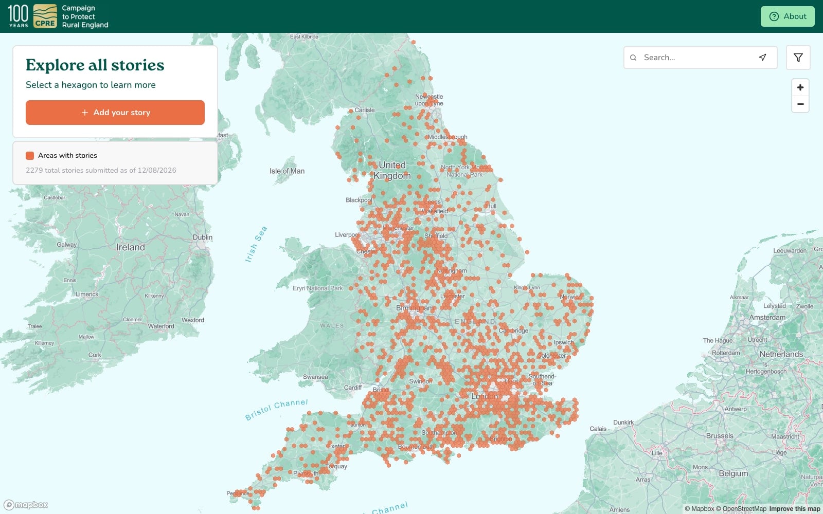
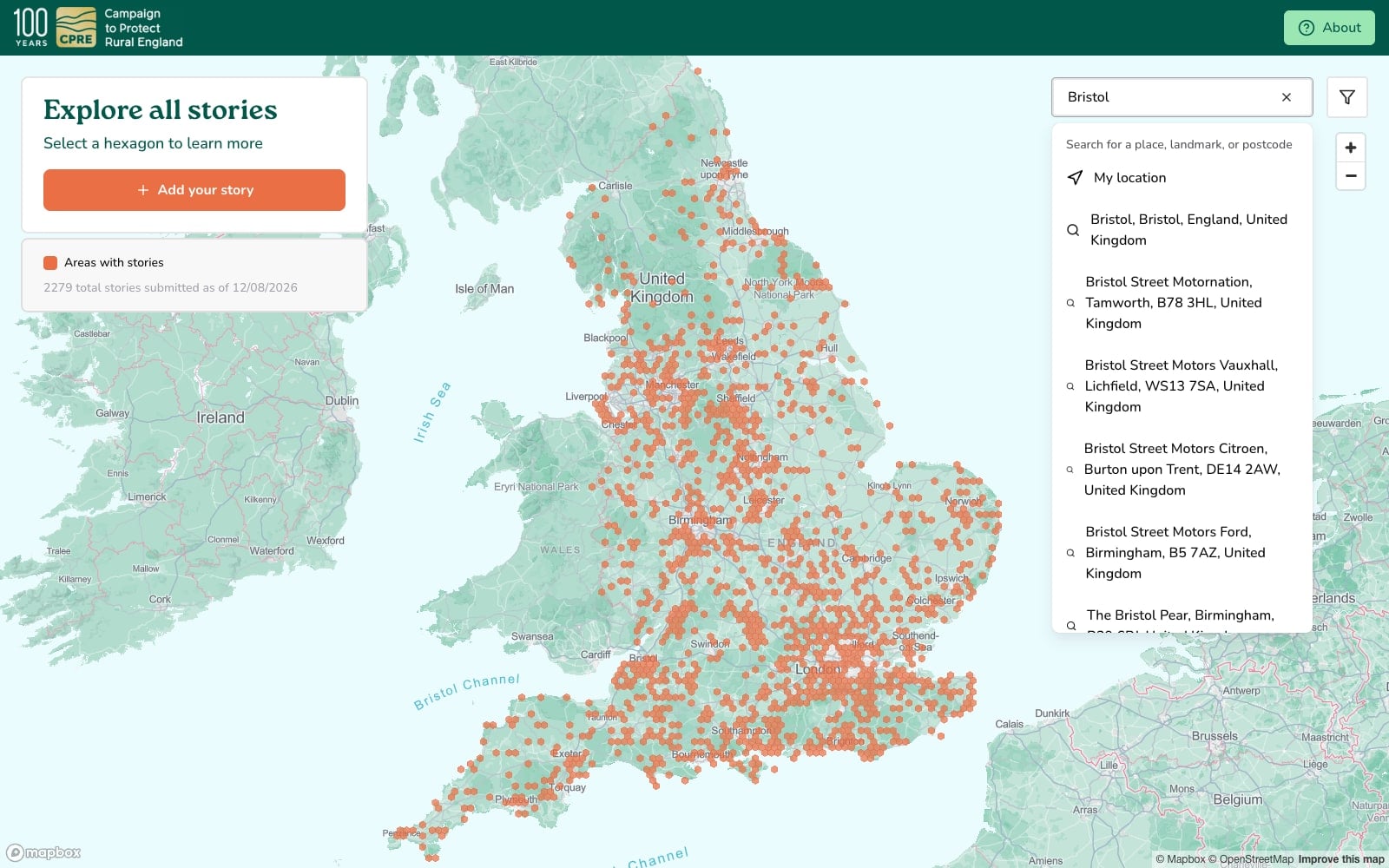
Image 1 of 4
On the Edge is an interactive map built for CPRE, the countryside charity, as the centrepiece of a national campaign in the charity's centenary year. The campaign is about edgelands, the fields, footpaths and scrubby margins where towns give way to open country. It launched in May 2026 alongside a CPRE garden at the RHS Chelsea Flower Show, and asks the public to record what the countryside on their own doorstep means to them. More than 2,000 stories arrived in the first three months.
The map is drawn in a style built for the campaign. Satellite-derived land use data separates woodland from scrub, agriculture, parkland and rough grass in varied greens, giving the countryside enough texture to be recognisable rather than generic. Labelling stays sparse and thickens with zoom, major cities first, then towns, villages and local roads. Maximum zoom is capped at roughly the size of one hexagon, which keeps the map from being used as a route planner or an access guide for land that is often private.
Contributors choose a five-kilometre hexagon rather than dropping a pin. At that resolution a story is about a stretch of countryside rather than about where someone lives. It also lets people praise a favourite corner without giving away where it is. Some people may not want their hidden gem pinned on a national map. Selecting a cell opens a short form, designed for a phone first: why the place matters, an optional first name, topic tags chosen or typed, and up to one photograph, one video and one audio clip, the last recordable in the browser so someone can talk about a place instead of writing about it.
The confirmation screen is not simply a thank you. It lays the new story out as a messaging thread alongside others from the surrounding cells, with the contributor's own placed second, so what they see is a community talking about the same stretch of country.
Every submission is screened before it reaches the public map. AI moderation runs the first pass and removes harmful content instantly, and what remains goes to a human queue where text can be edited with every version kept. Beyond that, a cell either carries stories or it does not, with no graduated shading, and the accounts inside one can be filtered by topic, by media type and by recency.
The application is built on Next.js and Payload CMS with Postgres, using Mapbox GL and PMTiles for the map.